What does Altitude mean?
Translated from Brockhaus Bilder-Conversations-Lexikon for the German People, 1841:
„A point’s altitude over a plane means the length of the vertical line which descends from such point to the plane, or in other words, the distance of the point from the plane. If a body is considered, altitude is the largest distance with which any point on the surface of this body stands off that plane which has been considered the body’s base. Since on the Earth, if taken as a sphere, water of all oceans must arrange itself so that everywhere it will stand off equally far from the centre of the Earth, one uses to determine the altitudes of points on the Earth surface, e.g. the summits of mountains, according to their elevation over sea-level. Often, however, the altitude is taken of an object over another plane on which it is situated, e.g. of a tower over the base on which it stands.”
From Wikipedia, the free encyclopedia:
Altitude is the elevation of an object from a known level or datum. Common datums are mean sea level and the surface of the WGS-84 geoid, used by GPS. In North America and the UK altitude is usually measured in feet. Everywhere else in the world the altitude is measured in metres.
Atmospheric pressure decreases with altitude. This principle is the basis of operation of the pressure altimeter, which is an aneroid barometer calibrated to indicate altitude instead of pressure.
Heights of mountains are generally given as heights above mean sea level. The Himalayas average 5 km above sea level, whilst the Andes average 4 km. Most other mountain ranges average 2 – 2.5 km.
The highest mountain on Earth is Everest, 8,848 m, set in the world's most significant mountain range, the Himalaya. Other definitions of height are possible. The peak that is farthest from the centre of the Earth is Chimborazo in Ecuador. At 6,272 m above sea level it is not even the tallest peak in the Andes, but because the Earth bulges at the equator and Chimborazo is very close to the equator, it is 2,150 m further away from the Earth's centre than Everest. (Caution: Huascarán in Perú comes very close – and eventually it all boils down to the question how accurate these altitude measurements are.) The peak that rises farthest from its base is Mauna Kea on Hawaii, whose peak is over 9,000 m above its base on the floor of the Pacific Ocean.
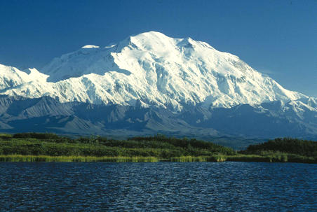
Mount McKinley (Denali) in Alaska has the largest visible base-to-summit elevation difference on Earth.
Altitude in aviation
In aviation, the term altitude can have several meanings. It is a fundamental tenet of flight safety that both parties exchanging information concerning this topic are absolutely clear which definition is being used. (Air Navigation, Department of the Air Force. AFM 51-40. 1 December 1989)
- True altitude is the elevation above mean sea level. In UK aviation radiotelephony usage, the vertical distance of a level, a point or an object considered as a point, measured from mean sea level; below the Transition Level this is referred to over the radio as altitude.
- Absolute altitude or height is the elevation above a ground reference point, commonly the terrain elevation. In UK aviation radiotelephony usage, the vertical distance of a level, a point or an object considered as a point, measured from a specified datum; below the Transition Level this is referred to over the radio as height, where the specified datum is the airfield elevation. (Radiotelephony Manual, UK Civil Aviation Authority. CAP413. 1 January 1995)
- Indicated altitude is the reading on the altimeter when it is calibrated to the local barometric pressure, referred to as the "altimeter setting". (See also QNH and QFE).
- Pressure altitude is the elevation above a standard datum plane (typically, 1013.2 millibars). Above a transition altitude, which varies by nation, pressure altitude is used to set the altimeter. Pressure altitude divided by 100 is referred to as the flight level.
- Density altitude is the altitude in the International Standard Atmosphere (ISA) at which the air density is equal to local conditions. Aircraft performance depends on density altitude, which is affected by barometric pressure and temperature. On a very hot day, density altitude at an airport may be so high as to preclude takeoff, particularly for helicopters or a heavily loaded aircraft.
Altitude regions
- Mountain medicine recognizes three altitude regions: (Non-Physician Altitude Tutorial, International Society for Mountain Medicine, http://www.ismmed.org/np_altitude_tutorial.htm)
- High altitude = 1500 m – 3500 m
- Very High altitude = 3500 m – 5500 m
- Extreme altitude = 5500 m – above
In the United States, a mountain is 1,000 feet or more in height from base to summit. A hill is 500 to 999 feet. A discernible hill that is less than 500 feet high is a knoll. A series of knolls constitutes a rolling plain. A plain is generally considered flat if it has no significant prominences (e.g., "hills" less than 20 feet high, though the range of height varies for a plain to be considered flat).
In the United Kingdom the Department for Environment, Food and Rural Affairs defines mountain as all land over 600 m. This is a close metric equivalent of 2,000 ft (which is 609.6 metres).
References:
http://www.defra.gov.uk/wildlife-countryside/consult/access/statut.htm
Edward Earl, Prominence listing
http://www.k-online.com/~esquared/outdoor/prominence/index.htm
Note: Nothing is simple enough not to come out complicated when talked about.
|